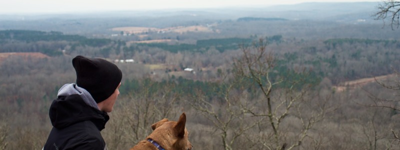
Explore any of the Shawnee National Forest’s amazing and beautiful hikes for spectacular views and getting intimate with rock formations and indigenous history, or for family-friendly adventures with stunning waterfalls, natural land bridges, and so much more. Shawnee, with hundreds of acres of forest, rock sculptures, and a smattering of lakes and waterfalls, offers a comfortable respite from daily life.
Garden of the Gods
Contents
Looking for breathtaking views and a short hike among some of the most unusual rock formations in the US? Garden of the Gods in Southern Illinois is a must-see. Garden of the Gods, the most prevalent hike in the Shawnee National Forest, offers visitors incredible insight into the geologic structure of Southern Illinois as well as a view that extends for miles high over the immaculate hills of the Shawnee Forest.
Garden of the Gods is situated in the Shawnee National Forest in southern Illinois. The Wilderness area is more than 320 million years old and encompasses over 3,300 acres of beautiful old growth forest. This region’s sediment rock is over 4 miles deep, and the fractured bedrock has created some fascinating rock formations that represent different objects. Camel Rock, Monkey Head, Indian Point, Anvil Rock, Mushroom Rock, and Big H are some of the rock formations. The Observation Trail is a.25-mile stone path that leads to some spectacular views of the Garden of the Gods Wilderness area. The park is open all year.
 There are two main trail systems in Garden of the Gods. The Observation Trail is the most well-known. It follows a.25-mile stone path that leads to some spectacular views of the Garden of the Gods Wilderness area as well as views of unusual rock formations. This is an interpretive trail with some interesting geological history about the area. Other trails lead to places like Indian Point, Anvil Rock, Mushroom Rock, and Big H. These trails connect and span approximately 5.5 miles. Maps are available at the park, which is open all year.
Observation Trail
The River-to-River Trail is the second major trail that runs through this area. The trail enters the park from the east end, just below the camping area, and continues west, crossing the blacktop to the Observation Trail area. The River-to-River Trail then heads south beneath the rock formations before turning west. It goes on for another 8 miles to Herod. About 1.5 miles west of Garden of the Gods, there is a good camping area with a stream for water. For the next three miles, there will be no more water.
Interpretive trail (.25 miles) Easy
From the disabled parking area, continue up the ramps to the left past the bathroom facilities.
 .01 Trail spurs to left to overlook of the south east.
- .014 Overlook of Camel Rock and Monkey Face
- .017 Trail descends, spur to the left leads to a tall narrow rock with a smaller rock wedged in between. Continue right.
- .1 Spur to the left leads to the top of Camel Rock and Monkey Face and loops back to main trail.
- .12 Trail continues to area for rock that has interesting iron deposit swirls called “Liesegange bands” The iron deposits in the rock did not erode as quickly as the surrounding rock, leaving the bands of iron in a swirling pattern.
- .13 Trail comes to a wooden foot bridge that leads through a narrow passage in the rocks.
- .15 Spur to the left to more rock formations. A bench to the right provides a resting place.
- .17 Trail continues to the right past a post area for horses. A trail at the end of the gravel lot leads to Anvil, Mushroom and Noah’s Rocks.
- .21 Trail follows along parking lot to an information area.
- .25 Returns to disabled parking lot.
Indian Point Overlook Trail (.66 miles one way, 1.7 loop) Easy
From the gravel lot at the backpackers parking lot.
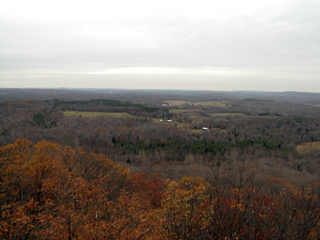 .00 Trail begins at parking lot heading south.
- .02 Small pond to your left.
- .10 Trail splits, beginning of loop. Continue right for shortest distance to Indian Point.
- .25 Trail levels off a bit.
- .50 Trail turns up to the left toward Indian Point
- .66 Indian Point. Nice place for campsite. Continue left to complete the loop
- .82 Trail descends slowly to the right.
- 1.2 Trail loops back to the west.
- 1.6 Trail merger. Continue right to return to backpackers parking lot. Pond will be on your right.
- 1.7 Backpackers parking lot.
Pharaoh Campground
Pharaoh campground is open year round and includes 12 sites. Facilities include picnic tables, fire pits, pit toilets, and drinking water. $10.00 fee. First come first served. Over night parking for backpackers is located at the backpackers parking lot, the first road on the left as you enter the park. For more information call 618-253-7114 or 618-658-2111.
Getting There
From Exit 54 at Interstate 57 and Illinois 13, drive 25 miles east on Illinois 13 to US 45 in Harrisburg. Turn right onto US 45 and drive south 1 mile to Illinois 34. Turn left onto Illinois 34 and drive 16 miles to Karbers Ridge Road. Turn left onto Karbers Ridge Road and drive 3 miles east to Illinois 10, turn right. Continue about 1 mile to Garden of the Gods Road, turn left. Look for Garden of the Gods Recreation area on your left.
From the south take Illinois 1 North to Cadiz Road. Turn left and continue west 6 miles to Karbers Ridge Road. Turn left and continue west for 4 miles to Illinois 10 (Garden of the Gods Road). Turn left for about 1 mile. Turn left into Garden of the Gods Recreation area.
Lusk Creek Wilderness
The Lusk Creek Wilderness has many trails that are used by both hikers and horse riders. Some trails are just for hikers, such as those in Natural Areas and the natural area at Indian Kitchen. Indian Kitchen is a popular hiking destination, but be aware that many parts of the trail will be exceedingly muddy during the wet season. Other places to visit include Owl Bluff, Natural Bridge, Saltpeter Cave, and Rock House.
Lusk Creek Wilderness area is located in the Shawnee National Forest and has some beautiful and interesting geology. Bedrock, similar to Garden of the Gods, lines Lusk Creek Canyon to the north and south. Large cliffs and rock houses are abundant along Lusk Creek. There are many plants and animals in this mostly undisturbed area. The Lusk Creek Wilderness was designated by Congress in 1990, and it now has a total of 6,352 acres.
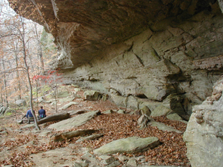 Horses share the trail so if it rains it can be mucky. This section of the River-to-River trail takes you from Concord Cemetery in the east to the Circle B Ranch in the west. The trail continues to Eddyville and eventually ends at the Mississippi river at Devils Backbone Park.
River-to-River Trail
Concord Cemetery to Circle B Ranch. White diamond marker with blue i (5 miles). Easy/Moderate. From top of One Horse Gap
- .00 Trail begins at Concord Cemetery and follows Raum Road to the left for a short distance.
- .04 Trail leaves the road and crosses a small creek.
- .10 Trail begins to ascend.
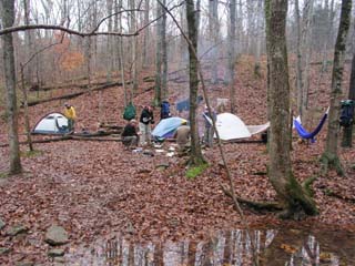 .5 Cross Little Lusk Creek
- .7 Looking road crosses trail, continue straight.
- .9 Trail enters stand of pines.
- 1.2 Cross Little Lusk Creek, trail continues along creek on the right.
- 1.4 More pines.
- 2.2 Trail comes to a T, turn right.
- 2.5 Tail comes to a T. turn left. You will come to several more logging roads, follow the trail markers and continue straight.
- 3.0 Small pond on the left. Nice place to camp.
- 3.2 Trail begins to descend.
- 3.4 Trail crosses creek and begins to climb to the right. Camp site here, but be sure to camp 300 ft’ from the trail.
- 3.7 Lusk Creek Camping area. Travel south towards Indian Kitchen and Bear Creek, travel north to Salt Peter Cave.
- 3.71 Ford Lusk Creek and follow trial to the left.
- 4.0 Trail continues up smooth exposed rock. Steep.
- 4.5 Cross small creek
- 4.9 Trail crosses road
- 5.0 Circle B Ranch
Getting There
From Herod take Raum Road to Concord Cemetery. Markers for the River-to-River trail can be seen for the first 1.5 miles. The first road to the right leads to Williams Hill. The highest point in the area. Continue till the next fork in the road, bear right. The next intersection is Hartsville. Continue left, after a short distance the road makes a 90º turn to the right. A trail head for the River-to-River trail can be found to the left at Concord Cemetery. The River-to-River trail follows the road for a short time before crossing the road at a small creek just before the next 90º left turn. The trail heads toward the Lusk Creek Wilderness area.
One Horse Gap
Part of the Shawnee National Forest, One Horse Gap is a natural narrow passage in the bedrock which the River-to-River trail passes through. The area above the gap has a moon like landscape that is unique. There is a small lake with in mile of the gap and just below the gap is a small tunnel between the rocks with a trickling stream that disappears under the rocks.
One Horse Gap is accessed by the River-to-River Trail or by road from Raum Road. One Horse Gap is a unique geological area. The rock formations remind me of a moon scape. Large areas are rounded and bare of vegetation.
The Gap is a natural narrow passage in the rocks thorough which the River-to-River trail passes. There is a large camping area with a fire rings. There is a loop trail that follows along the top of the ridge and then descends below the cliffs and returns to the gap. One Horse Gap lake is .5 miles south of the Gap.
One Horse Gap Loop
Loop trail (.4 miles) Easy. From top of One Horse Gap:
- .00 Trail begins to left along the ridge top and follows the contour of the ridge.
- .20 Trail descends below ridge. Trail merges with River-to-River trail. Trail to he left leads to Herod, continue right.
- .23 Interesting rock houses along the trail.
- .40 Trail intersects with trail to One Horse Gap Lake. Left to lake. Right to Gap camping area. Straight continues on River-River Trail below the bluffs.
Getting There
From Herod take Raum Road to Concord Cemetery. Markers for the River-to-River trail can be seen for the first 1.5 miles. The first road to the right leads to Williams Hill. The highest point in the area. Continue till the next fork in the road, bear right. The next intersection is Hartsville. Continue left, after a short distance the road makes a 90º turn to the right. A trail head for the River-to-River trail can be found to the left at Concord Cemetery. The River-to-River trail follows the road for a short time before crossing the road at small creek, just before the next turn, heading toward Lusk Creek Wilderness area. Just past the cemetery the road turns 90º to the left. Follow the road about a mile to the Old Grand Pierre cemetery. Turn left, continue .5 miles till you see the next gravel road. Turn left. at .25 miles the River-to-River trail crosses from the right and continues down the road for a short distance before crossing the road to the left. In about a mile you will see a trail head that leads to the right, it is about .33 miles to the top of the Gap.
River-to-River trail
One Horse Gap to Concord Cemetery.
White diamond marker with blue i (3 miles) Easy/Moderate
From top of One Horse Gap
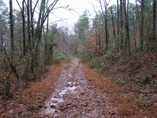 .00 Begin from camp area at One Horse Gap.
- .01 After passing through the gap follow the trail marker to the right.
- .02 On your right you will see some large boulders that have fallen together There is a walk through with a small creek that disappears under the rocks.
- .04 Trail continues to lose elevation as it crosses a small creek.
- .06 Trail begins to ascend to the left along the bottom of the bluffs.
- .12 Trail continues to climb.
- .25 Trail begins to level off.
- .5 Trail continues along bluffs
- 1.0 Trail reaches Benham Hill continuing to ascend
- 1.5 Trail enters gravel road. Good place to camp. Continue right down gravel road.
- 1.6 Trail crosses road and heads north following flat loggin trail.
- 2.0 Ponds on left
- 2.2 Pond on right. Trail begins to become rocky. Saw some wild turkey in this area.
- 2.8 Spur to right leads to nice camping area by small creek.
- 3.2 Concord Cemetery. Trail enters gravel road, turn left and follow road for short distance before crossing Little Lusk Creek to the west.
Shawnee National Forest
Harrisburg, IL 62946
(618) 253-7114

